Monitoring Natural Flood Management (NFM)
To help gather the evidence needed to demonstrate what can be achieved through the use of NFM, a comprehensive monitoring programme has been developed and implemented.
Outcome Measures 4 (OM4) – habitat creation and enhancement
NFM delivers multiple benefits, including improvements to habitats. Defra's Flood and Coastal Erosion Risk Management (FCERM) partnership funding strategy captures these benefits through the delivery of Outcome Measure 4, which is divided into two categories; OM4a hectares of habitat created or enhanced, and OM4b kilometres of river enhanced. Table 1 and Table 2 in the Partnership funding; Supporting guidance for Outcome Measure 4 provide additional detail about OM4.
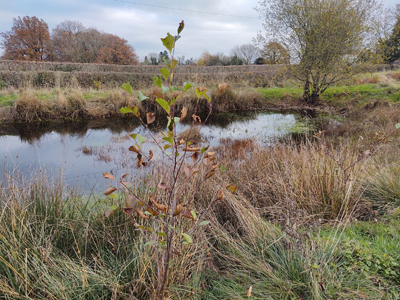
Attenuation area and tree planting at Jamie's Farm.
Soil research
By analysing the soil's structure, organic matter content, worm count and infiltration rate, it is possible to identify opportunities to improve the soil health. These improvements not only help reduce flood risk, but they also help to reduce nutrient losses from the soil and help prevent soil erosion. Good soil health is also integral to a sustainable farm business.
If you are within an NFM catchment and are interested in getting your soils tested, please get in touch and we can arrange for these tests to be carried out free of charge through our catchment advisor visits.
The soil testing method statement outlines our approach to soil testing within the NFM catchments.

Left: Soil in undersown maize field. Right: soil in bare maize stubble field. Image provided by the Wye and Usk Foundation.
To help us understand how different land management practices affect the soil's ability to hold moisture, the project undertook a comprehensive soil moisture analysis study, involving both arable and grassland scenarios.
In 2023, an MSc student at the Royal Agricultural University, Cirencester used this data to undertake their thesis, titled 'Investigating the role of agricultural soils within a natural flood management system in the United Kingdom' (W. Betts, 2023). It concluded that the data 'strongly suggests that maintaining soil cover whether grass or cover crops offer the best solution for retaining moisture' (W.Betts, 2023, pg. 48), noting this is linked to increased soil organic matter content which relates to improved soil structure and subsequent water movement and storage of water within the soil. Whilst little variance was observed between other variables (min-till, no-till, stubble, arable high organic matter), it noted that agricultural practices which promote a high standard of soil health and structure, for example min-till, would eventually result in flood risk reduction benefits. The study recommends further research to quantify flood risk reduction benefits (as factors such as soil type will influence results).
River and rainfall monitoring
To help us better understand how the catchments respond to different rainfall events and the impact that NFM measures are having on this, river and rainfall monitoring stations have been installed in all of the priority sub-catchments. This data, combined with local information, has helped us develop our understanding of how the catchments responded to the flooding experienced in Herefordshire in October 2019 and February 2020.

Left: Dulas Brook - river monitoring station. Right: Luston- rainfall monitoring station.
Rainfall monitoring images provided by Hydro-Logic Services (International) Ltd.
Data collected from these monitoring stations is publicly available at:
- Website:Timeview3 Telemetry
- User name: Wye and Lugg NFM Project
- Password: slowtheflow
Rainfall data for Brimfield brook catchment is being collected and is available to view from Environment Agency monitoring station 1792.
Fixed point photography monitoring
Project volunteers have provided photo evidence to show how the watercourses respond to rainfall events. By repeatedly taking photographs of the same location it is possible to gather anecdotal evidence to show how the NFM measures are impacting the catchments response during a flood event.

Fixed point images showing Norton Brook and Pudleston Dingle water levels photographed over time period February 2020.
Education
To help educate younger generations about NFM and develop their knowledge of flooding, we have produced two educational videos aimed at KS2 and Year 7 pupils. These resources are available on The Wye and Usk Foundation's website